Local News
Glider filmed portion of fatal October 7 tow-plane flight
According to the preliminary report of the National Transportation Safety Board much of the fatal October 7 glider tow plane flight out of the Front Royal Airport (FRR) was captured on film.
“The flight instructor in the glider recorded a video of most of the flight. While the recording did not capture the actual impact of the airplane, it captured portions of the airplane’s flight just prior to impact. A copy of the recording was forwarded to the NTSB Vehicle Recorders Laboratory, Washington, DC, for further examination,” the initial NTSB report released October 11 states.
Reston resident, 76-year-old Steven B. Zaboji, was the tow plane pilot killed in the Saturday afternoon crash. Zaboji was an experienced pilot in both single and multi-engine flight.
“His most recent Federal Aviation Administration second-class medical certificate was issued on October 1, 2015. At that time, the pilot reported a total flight experience of 11,953 hours,” the report observes, adding, “The pilot held an airline transport pilot certificate with a rating for airplane multiengine land. He also held a commercial pilot certificate with a rating for airplane single-engine land. Additionally, the pilot held a flight instructor certificate with ratings for airplane single-engine, airplane multiengine, and instrument airplane.”
An interview with the glider pilot, operating from the rear seat of the two-seat cockpit with a passenger in the front seat, indicated, “that the takeoff from runway 28 was normal and he momentarily looked away from the tow airplane at a low altitude. When he looked back, he did not immediately see the airplane and then noted that it was below and to the right of the glider. Additionally, the flight instructor noticed slack in the cable attaching the glider to the airplane. He then released the cable, performed a 180° turn, and landed on runway 10 uneventfully. While approaching the runway, the flight instructor saw a fireball from where the airplane had been descending. Several witnesses at the airport stated that the takeoff appeared to be normal, but then the airplane pitched down, descended below the glider and turned right before impacting terrain.”
Acknowledging the safe return of the glider in the immediate aftermath of the crash, Airport Manager Reggie Cassagnol observed that emergency tow line releases are an ongoing part of the training regimen of the Skyline Soaring Club’s operations at FRR.
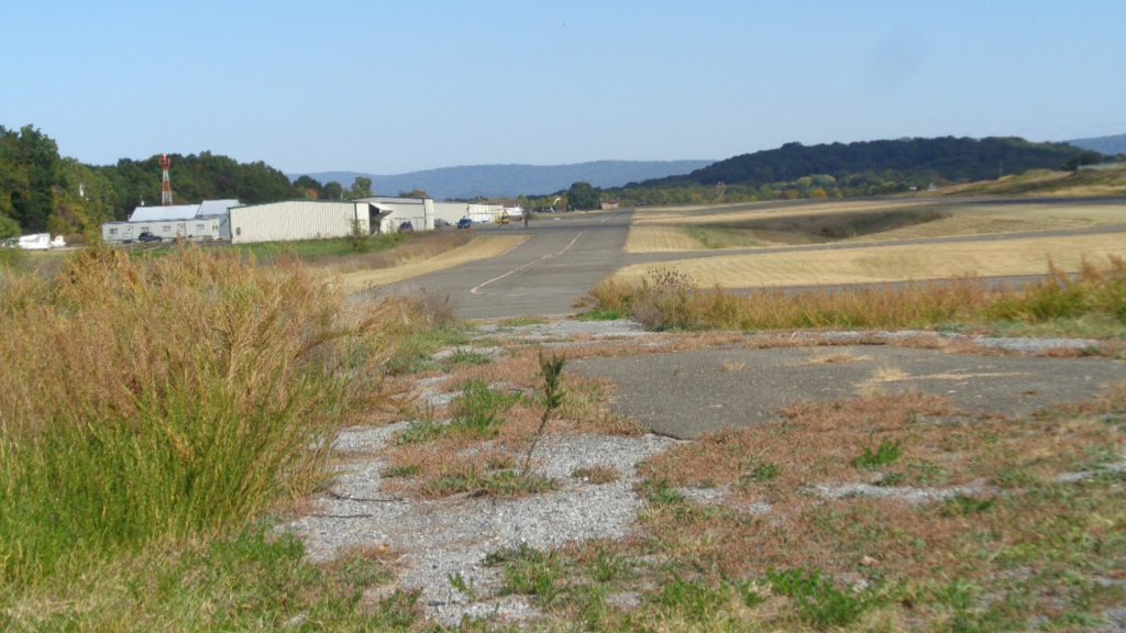
The view east back down the FRR runway from Ridgeway Dr.; below, a grim scene at FRR terminal following fatal crash. Photos/Roger Bianchini
The NTSB preliminary report does not comment on how the glider pilot’s description of slack in the tow line as the plane suddenly began descending impacts one theory that unexpected turbulence may have contributed to the accident. Saturday, October 7, was a generally windy day in Front Royal and Warren County. No information on any radio communications between the plane and the terminal or the plane and the glider has yet been acknowledged or released. The pilot’s age has raised questions about a possible health emergency impacting the pilot immediately after takeoff.
Of the accident itself, the NTSB initial report states, “The wreckage was consumed by a post-crash fire and located in the backyard of a residence, about 1,600 ft northwest of the departure end of runway 28. A small crater was observed in the grass, consistent with engine contact and fragments of the propeller were also located near the crater. The main wreckage came to rest upright, on a magnetic heading of 315°, about 65 ft north of the crater” with “the tow cable located in the debris path.”
The plane, a single-seat, single-engine Piper Pawnee was manufactured in 1981. “Review of the maintenance records revealed that the airplane’s most recent annual inspection was completed on February 2, 2017. At that time, the airframe had accumulated about 8,265 total hours of operation and the engine had accumulated 468 hours since overhaul,” the NTSB reports.” see related story
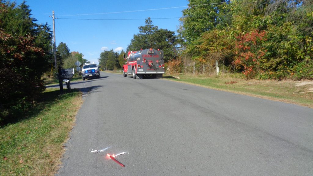
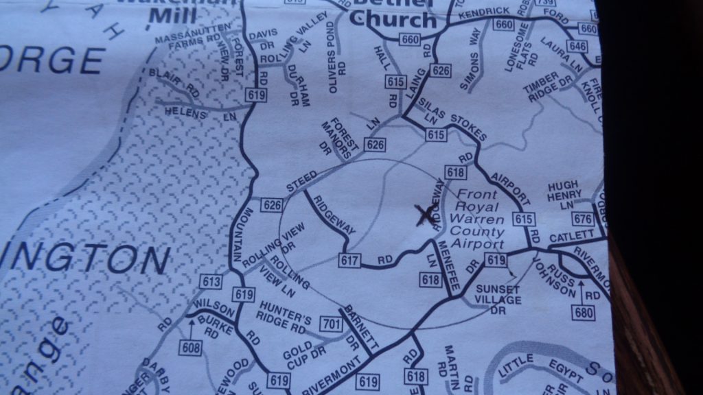
The entrance to the property where the crash occurred; below, the airport on a local map – an ‘X’ marks approximate site of the crash just northwest of the airport.

4 Stimulating Activities for a Healthy Brain After 50

The First Amendment: America’s Unique Foundation of Freedom

How to Tackle Credit Card Debt

Summer Enrichment Camp Gives Teens Hands-On Learning Opportunities

VDOT: Warren County Traffic Alert for April 6 – 10, 2026
David Silek to Remain in Chairman’s Seat of WC Republican Committee Pending 6th District Appeal Decision

Sales Set to Bloom Like Daffodils This Spring

America 250: The Bookseller Who Helped Save the Revolution

Business Growth Series: Why Good Businesses Still Struggle to Grow

Brownies with Mini Chocolate Easter Eggs

Shenandoah Downs Opens 11th Season April 11 with Tribute to Roger Hammer

We Don’t Know Everything About DNA

How PAAS Came to Dominate the Easter Egg Dye Tradition

Spanberger Signs Bipartisan School-Safety, Student Support Bills Into Law

Melanie J. Pomeroy (1958 – 2026)

David Benjamin Heller (1990 – 2026)
1776 Wasn’t Just About Independence

Three-Tiered System for Urban Agriculture Based on Lot Size Takes Shape at Town Planning Commission Work Session

Child Abuse Awareness Month Brings Focus to Reporting, Prevention in Warren County

National Dental Hygienists Week: Is Your Oral Care Routine Optimal?

The Coin That Traveled Through Time and Space

One “What If?” Question Is Changing the Future of Farming

AA Speaker to Explain Recovery Program at United Methodist Men’s Dinner
Jeannette M. Hyland (1944 – 2026)
