Local News
Hazardous Weather Outlook for our area west of Elsa’s northward path
Thursday morning, July 8, Warren County Emergency Services Coordinator Rick Farrall issued the following report on potential weather impacts as Tropical Storm Elsa tracks up the northeast after its landfall along the northern Gulf Coast of Florida midweek. And while impacts were projected as minimal on Tuesday, by Thursday we were considered in a “be on the watch Outlook” area for possibly more severe than normal wind and rain as Elsa heads for Virginia’s eastern coastline maintaining its “tropical cyclone” counterclockwise spin. Below is Farrall’s updated weather report for the coming seven days in its entirety:
Tropical Storm Elsa is expected to track up the East Coast and maintain tropical cyclone conditions in our region through early tomorrow afternoon:
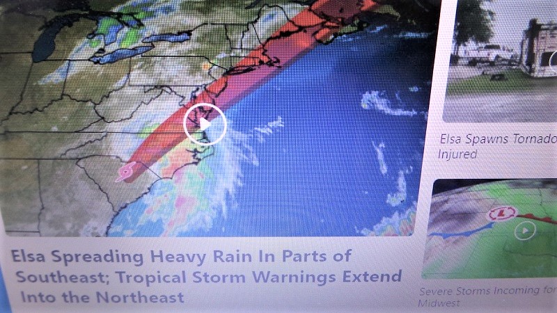
Weather Channel radar image of Elsa’s projected northward path. Royal Examiner Photos by Roger Bianchini
As of 5:10 AM EDT Thursday, July 8, 2021:
This Hazardous Weather Outlook is for portions of eastern West Virginia, northern and central Virginia, and central and western Maryland.
DAY ONE: Today and Tonight
A severe storm with locally damaging wind gusts is possible this afternoon and evening. An isolated instance of flooding is possible as well.
DAYS TWO THROUGH SEVEN: Friday, July 9 through Wednesday, July 14
There is a slight severe storm threat for Sunday and Monday. Scattered severe storms are possible during the afternoon and evening hours each day.
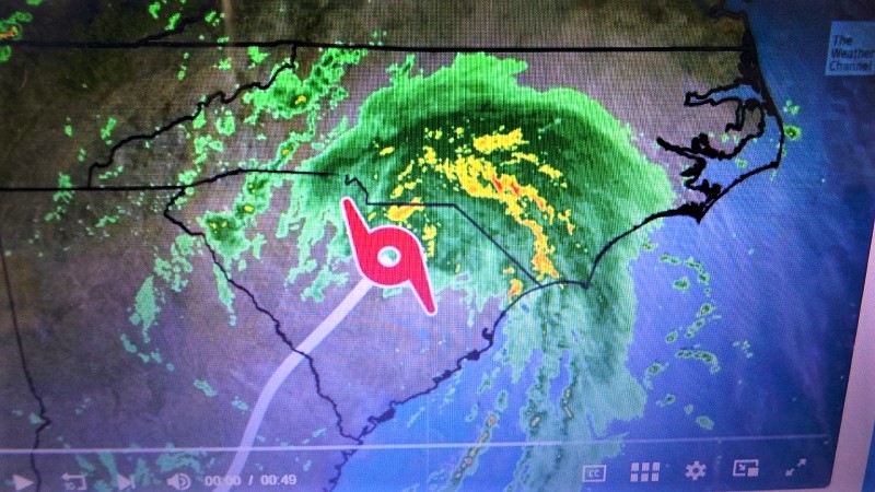
Weather Channel radar image of Elsa crossing into North Carolina Thursday. – It is likely those outer bands pictured to left of the storm’s body that we are on the lookout for as the day progresses into evening.

Sales Set to Bloom Like Daffodils This Spring

America 250: The Bookseller Who Helped Save the Revolution

Business Growth Series: Why Good Businesses Still Struggle to Grow

Brownies with Mini Chocolate Easter Eggs

Shenandoah Downs Opens 11th Season April 11 with Tribute to Roger Hammer

We Don’t Know Everything About DNA

How PAAS Came to Dominate the Easter Egg Dye Tradition

Spanberger Signs Bipartisan School-Safety, Student Support Bills Into Law

Melanie J. Pomeroy (1958 – 2026)

David Benjamin Heller (1990 – 2026)

1776 Wasn’t Just About Independence

Three-Tiered System for Urban Agriculture Based on Lot Size Takes Shape at Town Planning Commission Work Session

Child Abuse Awareness Month Brings Focus to Reporting, Prevention in Warren County

National Dental Hygienists Week: Is Your Oral Care Routine Optimal?

The Coin That Traveled Through Time and Space

One “What If?” Question Is Changing the Future of Farming

AA Speaker to Explain Recovery Program at United Methodist Men’s Dinner
Jeannette M. Hyland (1944 – 2026)

Allen William Derflinger II (1959 – 2026)

Warehouse Clerk: A High-Demand Job—Even With Robots

FDA Cracking Down on Compounded GLP-1 Drugs

“Christmas in April” or Overspending? Budget Draws Criticism

Court Ruling Voids Prince William Data Center Rezoning, Raising Stakes for Local Debate

Spanberger Signs First Bills Targeting Healthcare, Housing and Energy Costs
